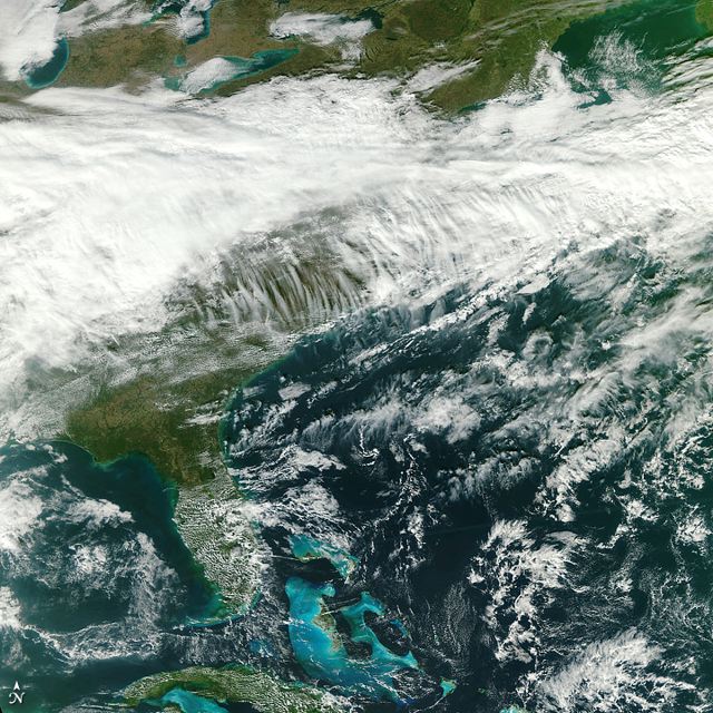
 Eastern North America from the Great Lakes to Cuba from 512 miles/824 kilometers above Earth. Credit: NASA/NPP Team at the Space Science and Engineering Center, University of Wisconsin–Madison.NASA’s newest Earth-observing satellite launched in October and returned its first image in late November: this crystalline view of eastern North America. The satellite is the NPP (NPOESS Preparatory Project), one of a new generation of satellites designed to collect critical climate and weather data. The “first light” image above was captured by the VIIRS (Visible Infrared Imager Radiometer Suite), an onboard instrument that collects in visible and infrared wavelengths from 22 channels across the electromagnetic spectrum. This new view will greatly expand our ability to observe changes on Earth’s surface—fires, ice, ocean color, vegetation, clouds, and land and sea surface temperatures—and deepen our understanding of global changes underway, both human-caused and natural.


