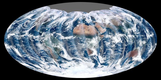
 First global image from VIIRS. Credit: NASA’s NPP Land Product Evaluation and Testing Element.A couple of weeks ago I posted the first image from VIIRS (Visible Infrared Imager Radiometer Suite). Now we see it with eyes wide open, providing the sharpest view yet of our world. VIIRS’ eyes are based on radiometric imagery in visible and infrared wavelengths, capturing images of Earth’s land, atmosphere, and oceans. Its eyes will profoundly deepen our understanding of global change—human and natural—including changes in ocean temperatures, cloud cover, and wildfires. Its vehicle is the NPP satellite flying a Sun-synchronous orbit on a unique path that takes it over the equator at the same time on the ground for every orbit. This keeps the satellite at the same angle between Earth and Sun so that all images are similarly lit. This first complete global view was compiled on 24 November 2011. Click here for higher resolution image. It’s breathtaking.


